Best Protected Area in Iran
Welcome to NATIONAL PARKS WORLDWIDE with the national parks, nature reserves and other protected areas of all regions of the world. National parks are the prime locations of wild and untamed nature; in many countries they are the most exciting and favorable places to visit, if you can find them. This following list is your first help for getting to the national parks of Iran. In many developing countries, the protected areas are still difficult to get to and some of them are still inaccessible. That is the reason why local travel agencies are often reluctant and unwilling to take you there, while others have their own agenda, favoring a lodge in a private reserve with insignificant forest or nature. And yet, with the proper knowledge, transportation and gear, visiting national parks is usually relatively affordable, provided that you don’t expect 5 star accommodations.
On this pages you find a list of Iran’s protected areas. Criteria for the selection of National Parks of Iran include natural beauty, unique geological features, unusual ecosystems, and recreational opportunities. Enjoy planning your vacation in Iran.
National Parks of Iran
For their lasting conservation, protected areas need a lot of visitation and observation, something that is lacking in developing countries like iran. In order to promote visitation to national parks, we created this information. The accuracy of our list varies considerably per country and is still incomplete for most countries of the world, but we are continuously working on improving them there are more protected areas in iran that might be omitted. As the lack of visitation continues to be one of the prime drawbacks for their conservation, we decided – after long hesitation – to organize national parks tours that are guaranteed to take you to the best national parks of each country, one country at the time. Currently we offer fantastic National Park tours in the below list:Alborz-e-Markazi (Central Alborz)
-
- Angora
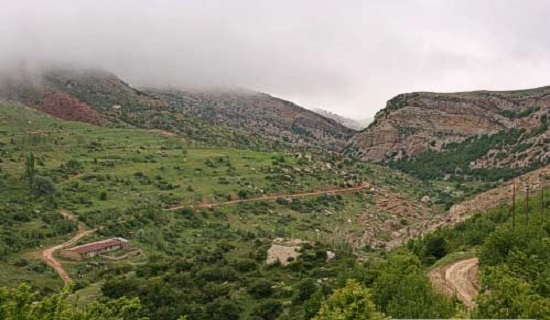
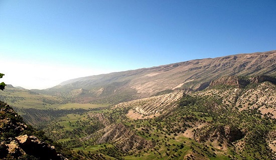
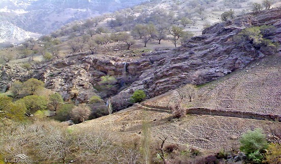
This protected area, which looks like a rhinoceros, is a mountainous hilly area in mahneshan County. There are three climatology stations including synoptic and pluviometric stations in the area. Angoran Protected Area has been under protection since 1970.
-
- Arasbaran
Arasbaran Protected is the 9th Biosphere Reserved in Iran which covers an area of 78560 hectares with a circumference of 134 km. The altitude varies from ca. 256 m in the northern part to 2896 m which is the highest elevation in southern part of the area. Due to the importance of the area in having a rich flora (about 1000 taxa) and fauna specially presence of rare species such as Lyurus mlokosiewiczi in 1971 was conserved and UNESCO was listed it as a wildlife refuge since 1976.


-
- Arjan
60 km west of Shiraz Arjan and Parishan protected regions are located in a 65-thousand hectare space. In this region, juxtaposed to Parishan and Arjan international lagoons, also 2900 m Chah Barfi summit and some 800 m lower regions are sited. This wide range of ups and downs creates diverse climatic conditions. Consequently, the flora and fauna is diverse which includes 407 flora species, 48 mammal species, 370 creeper species, 3 amphibian species and 203 bird species of which 11 species are endemic to this region.


-
- Bahramgor
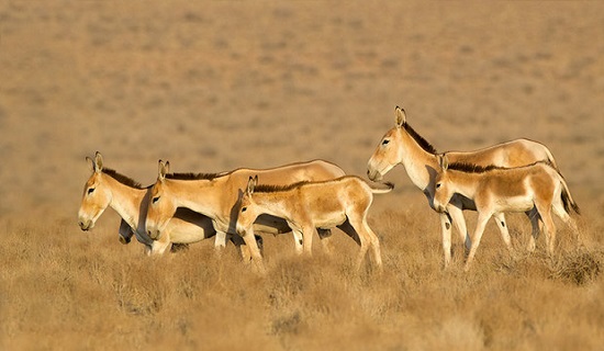
The current status and distribution of caracal Caracal caracal in Bahram’gur Protected Area (BPA), southern Iran, were studied using different methods for 12 months. Direct observations were restricted to spotlighting at night, a method which produced three caracal observations. Twelve photos of a male caracal were taken with camera traps. The main prey items were determined from a limited number of scat samples to be cape hare Lepus capensis and various rodents. Attack by herd dogs and road kills were determined to be the main threats facing this species in BPA.

-
- Bazman
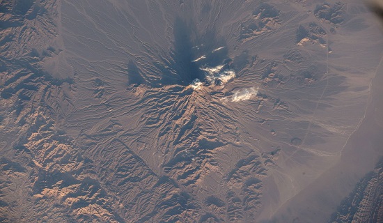
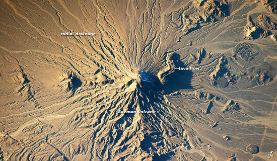
Bazman volcano is located in a remote region of southern Iran, within the Bazman Protected Area of Sistan and Baluchestan Provinces. While the volcano has the classic cone shape of a stratovolcano, it is also heavily dissected by channels that extend downwards from summit.
This radial drainage pattern-similar to the spokes of a bicycle wheel-is readily observed from the International Space Station. Such patterns can form around high, symmetric peaks when water runoff and erosion is not constrained by barriers to flow or resistance by geologic materials. The result is essentially even distribution of water runoff channels around the peak.
While there is no historical or geologic record of volcanism at Bazman, some fumarolic activity (gas and steam emissions) have been reported, according to the Smithsonian Institution National Museum of Natural History’s Global Volcanism Program. The summit of the volcano (3,490 metres above sea level) is marked by a well-formed explosion crater. Lava cones on the flanks of the main volcano are associated with well-preserved lava flows; a particularly striking example is visible on the north flank of Bazman. Together, these observations and features suggest that Bazman may be dormant, rather than extinct.
-
- Dasht-e-Naz
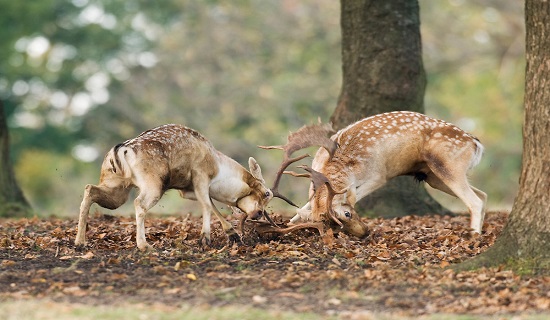
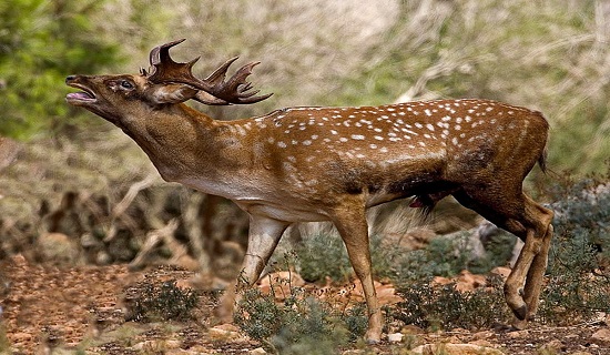
The region in Mazandaran Province was selected to keep Persian fallow deer in 1963. Beautiful forest landscapes, proper access roads and the presence of Persian fallow deer in the region. Have attracted researchers and other people interested in nature
-
- Jahannoma
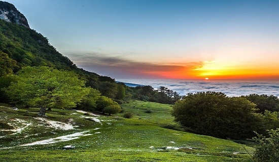
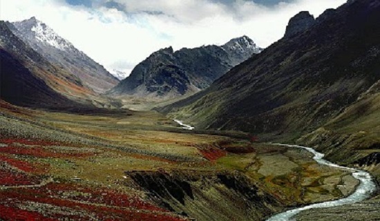
Jahan Nama is a village in Chaharkuh Rural District, in the Central District of Kordkuy County, Golestan Province, Iran. At the 2006 census, its population was 99, in 43 families.[1] This area is situated in the southern heights of Gorgan and the southeast of Kord Kooy. In 1973, it was claimed as a protected place with 30,650 hectares in area. This region was a recreational area for people of Gorgan and its nearby villages. Some important regions like Torkat, Chalestan, Cholqoleh, Aq Reza, Chakel Geda, Landeh Kooh, Talou, Khoshdasti, Landou and Maqzi, are around this protected area.
The most important varieties of wildlife are: wild goat, wild sheep, vension, panther, wolf, beer, owl, eagle, shoulca, weasel, and porcupine and its important plants are: Rosh, Azad, Barberry, Sorkhdar, Kolahe Mir Hassan, Bolandmaza Namdar, Borage Cowslipe, Ras, and Darmaneh. Several studies in the area during 1999, 2000, 2004, 2007 and 2008 found 1350 specimens, which included a total number of 607 vascular plant species that were identified from this area belonging to 329 genera and 85 families.[2]
The most important rivers and springs of this protected place are: Sefid Rood, Tarkan, Mahzi, Chaar Baq, Ziyarat, Marsang, Sbumargah, Shahpasand, Haji Abad, Gachian, Mord Cheshmeh, Vara, Khosh Dasti, Kalichal, Qormehtou, Pazeebon. Ancient relics of the said area are: water tank, ancient center of Kamarsarak and Jelingbling, Imamzadeh Razi and Marzieh, and the tower western of Radkan.
-
- Lar River
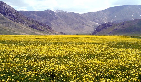
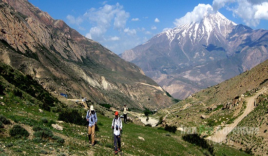
Site description The site comprises 20 km of the upper Lar valley in the high Alborz Mountains, from 2,450 m to peaks at 4,540 m. It lies above the Lar Dam, c.10-30 km upstream from the small town of Polur and c.40 km north-east of Tehran. The Lar is in the Caspian watershed, but at this point lies in a rain shadow and the area is relatively arid. For much of its length, the river meanders across a broad, flat-bottomed valley c.500-1,000 m wide. Habitats include a fast-flowing river with extensive shingle banks, patches of dense riverine Salix and Tamarix scrub (with a few trees up to 7-8 m high), small areas of natural wet meadow, open hillsides with steppic vegetation, a number of small, spring-fed alpine meadows in side valleys, and the high crags and summits of neighbouring peaks. There is grazing by sheep, goats and horses. The area was a regular bird-ringing site of the Department of the Environment’s Ornithology Unit in the 1970s.
Key biodiversity See box for key species. The area supports a typical high Alborz avifauna, including a good population of Tetraogallus caspius, and also appears to be of considerable importance as a staging area for migrant passerines (e.g. Phylloscopus trochiloides nitidus), especially in autumn, when the dense shrubbery and wet meadows along the river provide rich feeding habitat. At least 97 species have been recorded in the valley.
Non-bird biodiversity: None known to BirdLife International. Area: 28,000 ha
-
- Miandasht
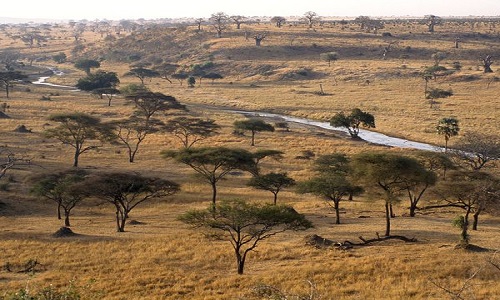
Mian dasht wildlife shelter with an approximate area of 85 thousand hectares is located in the east of Jajarm town. This area is preserved by the environment department since 1973 and by having nearly 3500 deer and Asiatic Cheetah it is considered as one of the best habitats of these two animal species in the country. With an arid and semi-arid climate, Miandasht is considered as one of the richest steppe habitats of the country which has several animal and plant species in its heart. The permanent river of Kalshour with its north to east current flows in the middle of Mian Dasht.

-
- Parvar
Located in-between Caspian Hyrcanian Mixed Forests and Kavir Desert of Semnan Province, Parvar Protected Area, spanning an area of 66000 hectares, is a reflection of both regions. Due to this fact, the region has three different climates: sylvan, montane and dry. Affected by its varied environment and climate, Parvar Protected Area can be deemed as one of the rich wildlife habitats. En route the protected area, you will come across different natural attractions from eye-catching countryside villages to rivers flowing along mountains. Although the open season is from late September to early January in the area, as a recommendation, it would be nice to catch the sceneries by shutter rather than catching them by trigger.
